Date: 6th January 2024.
Weather conditions: Excellent. Sun, clear blue skies, and not particularly cold. A lot better than the crud that has afflicted most of the country for the last few weeks, anyway.
County Top bagged: Penlle’r Castell, which is the highest point of, officially, the City and County of Swansea. On the 1:50,000 OS map this has a spot height of 1,227 feet/374m above sea level, at grid reference SN664094. The 1:25,000 shows a height of 10 feet/3m lower, but this spot is marked on the nearby tarmac road and it seems clear (both from the map and on the ground) that the actual highest point does sit away from the road, so the 374m height can be accepted.

The name of this summit is a matter of debate. The Times Atlas of Britain states that the highest point in the City and County of Swansea is called Mynydd y Betws, but while this might refer to the general area, on the OS map that label appears at least a mile away from the summit. Wikipedia suggests the hill is known as Mynydd y Gwair, but that label appears even further away. I will therefore stick with Penlle’r Castell, which apparently translates from Welsh as “Summit of the Castle Place”. And no, I don’t know what the apostrophe stands for (or maybe it’s the genitive case).
Historically this point was in Glamorgan, of which Craig y Llyn was the Top. Swansea, like most of the rest of the present-day Welsh authorities, was formally created in 1996, so that was the point at which Penlle’r Castell became a modern Top.
By altitude this ranks 70th of the modern Tops and 87th on the full list.
[ << Cairnpapple Hill, West Lothian (77) | (79) Bow Brickhill Heath, Milton Keynes >> ]
Start and end point of walk: Started and finished at the car park for the Lower Lliw Reservoir (plus associated “Café and Fishery”), which is at about SN650033, about a mile from the village of Felindre.
The walk took me 3¾ hours. I arrived at 9am and the car park was mostly empty, but by the time I returned it was packed out.

Pub at end: There’s no alcohol available at the café, but it’s a nice place to get a cup of tea, or food, at the end of the walk. In Felindre is a pub called the Shepherd’s Rest, but I didn’t go in so don’t know what it’s like.
Swansea seems to maintain a large number of pubs, including lots concealed in rows of terraced houses on back streets, which is one reason I liked the place: see below.
Distance walked: 10.6 miles/17km approximately.
Total ascent: 950 feet/290m approx.
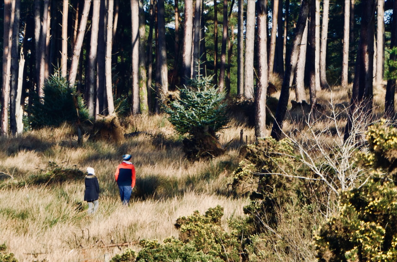
Difficulty: ★★★. As far as the dam of the Upper Lliw reservoir the walk can be done in heels and with a pushchair — and I had visual evidence of this on the day. But beyond that point it gets muddier, and it’s also a longish walk.
Ease of access: ★★. By car it is easy: this took me 25 minutes to reach from Swansea city centre, and it’s only a couple of miles from junction 46 of the M4. However, by public transport it is tricky. There is only one bus a day to Felindre and it’s not timed to help the walker.

An alternative, however, is to come at the summit from the other side, via Pantyffynnon or Ammanford, which have train and bus connections to Swansea.
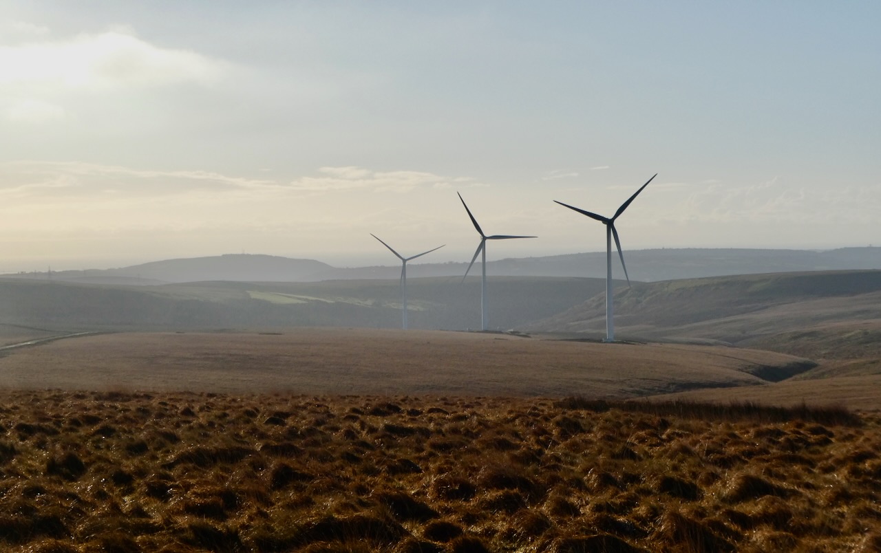
Scenic qualities: ★★★. This is pleasant countryside and there are some good views from higher up, for sure. The actual summit is drab, though. And bear in mind that anyone who has a dislike of wind turbines isn’t going to get off on the scenery.
The area: In my life I had never previously been to Swansea before this weekend, and I was pleasantly surprised by it. For a start, I never knew it had a spectacular beach (why isn’t this a massive seaside resort city like Brighton or Blackpool?). As already mentioned it has seems to have retained a lot of good pubs, and across a Friday and Saturday night in the city — including the stadium of its football team (see the commentary) — no idiots were encountered at all, which always helps give a good impression of a place.

This opinion was developed without even going to the Gower peninsula, which is within the ‘City and County’ boundary, and is often reckoned one of the most beautiful stretch of coastlines in the country. I think it’s somewhere worth coming back to.
Map: The walk just about squeezes onto the side of OS Explorer 178: Llanelli & Ammanford. The paper version of this map seems to have last been updated in 2013, and it doesn’t show the wind farm.
On this summary map, the walk runs from south to north, and I went round the loop anticlockwise.

Route: This was a decent walk, with good views, though it’s not a dramatic one. A lot of it takes place on roads or hard-topped paths, which makes it relatively easy going but also reduces the ‘keeping it real’ factor. All the same, I still got wet feet; there are some muddy parts, and fording a river at one point was awkward. Wear decent boots.
There are two reservoirs in the Lliw valley, with the walk starting beside the lower one. You can go round this on either shore, but I stuck to the right-hand side, the side the car park is on. After a short period on the road you can drop down to a terrace path above the lakeshore, which is prettified by some nice sculptures (see the picture).

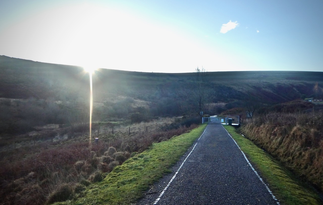
When this path ends, return to the road, and keep going along it as it rises gently towards the dam of the second, Upper Lliw reservoir. Beyond this point the good road surface comes to an end and there is a short muddy stretch, though it does improve again as the track rises gently through a pine forest and reaches open moorland before ending at the minor road that connects Clydach and Ammanford. Turn left here.
The tarmac goes all the way to the summit, but tramping along it will start getting a bit monotonous, and the map shows the ‘Gower Way’ as bearing off to the right where the road reaches the first crest. This track is fairly clear on the ground but in poor visibility I would stick to the road, as to reach the summit you eventually have to bear left off pathless ground.

Penlle’r Castell is the third consecutive CT summit I’ve reached which has some kind of ancient earthwork on the top, after Garth Hill and Cairnpapple Hill, but unlike those other two the ‘ruins’ are really not clear — in fact I admit to missing them altogether. Checking the map afterwards shows that the remains (reputedly, a 13th century fort) do not sit on the actual summit, which is very flat, the exact highest point being hard to determine.
I didn’t fancy returning exactly the same way so instead crossed the road beside the summit and headed down the track marked on the map as ‘St Illtyd’s Walk’, which leads into the wind farm. There are some extensive views north from here, over the flat lands of Carmarthenshire. After a while the track reaches the turbine access road.

I discovered that some of the paths marked on the OS map in this area no longer seem apparent on the ground, and the easiest way to proceed from here will be to follow the little red signs saying ‘Exit’ (meaning, from the wind farm). This road leads down the western side of the valley of the infant Afon Lliw.
Past the last of the turbines, take the path on the left which drops back down to the Upper Lliw reservoir. If there is a path that drops down from here direct to the dam, as marked on the OS map, I could not find it; instead I ended up on the track that heads east, back to the road, and where this fords the Afon Lliw you will probably, like me, get wet feet. I would have rather been on the other route but it didn’t happen.
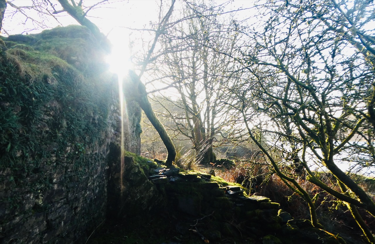
I was also tempted off this path at one point by a track that looked as if it would lead more directly back to the pine forest ahead, but this petered out and I had to ford another stream (more wet feet) and crash through undergrowth for fifteen awkward minutes before getting back to the main track. I did discover the ruin pictured here (this must be what is marked on the map as Brynllefrith, a place that is otherwise invisible), but my advice is to stick to the path once on it, and the map above reflects this.
If this is done, the last three miles of the walk will be the first three miles, in reverse: back down through the pine forest, the Upper reservoir shore, and past the dam, onto the tarmac access road to return to the car park. You could go along the other shore of the Lower reservoir for a final bit of variety.
Wales Once More Commentary: Even before starting this project I had done fairly well in my life when it came to getting about the UK. Checking the identities of the 30 most populous cities in the country, the only four I had never been to before 5th January 2024 were Bristol, Plymouth, Coventry and Swansea (Sunderland should technically be added to the list, but there I have, at least, visited the local authority, just not the city itself). So this first weekend of the year sees Swansea get ticked off this particular, diminishing personal list.
And I liked the place, as did Clare, so she said. It had a combination of good features — a great, totally unexpected beach, characterful public houses, cute terraces of housing, and not a bad football stadium either. This was the latest in a sequence of CT/footie doubles (six in a row in fact, though I won’t bore you with the details). If Swansea City FC hadn’t drawn Morecambe (the wife’s favoured team) in the FA Cup Third Round I would almost certainly not have made such a quick return to south Wales after coming in November, but they did, and so we both found reasons to make a weekend of it.

The weather totally worked out, as well. The main reason I have not walked as much as planned over the last couple of months has been the incessant dampness. A great deal of rain has fallen, and by now many parts of England, at least, are sodden enough for there to have been some significant flooding. But today was glorious. I did consider a higher-altitude walk, having looked at Fan Foel in the western Brecon Beacons (Top of Carmarthenshire), but that would have tripled the amount of driving I had to do on the day so felt a step too far. I’ll come back for it — of course.
Had I been at home today, with such a weather forecast, I would have gone to the Lake District, but never mind. Returning there is definitely now on the agenda before the rest of January is done, though. So there is unlikely to be another CT walk for at least a few weeks.

Wind turbines were a factor today, you can see that from the photographs. There are arguments brewing at home at the moment about plans to build a wind farm on Walshaw Moor, across territory I visited when bagging Withins Height. On our drive down through Powys in mid-Wales there were ample signs of protest against more ‘turbines and pylons’ in that region. And I do get it. While I do believe that the push for ‘green energy’ is the only sensible way forward in the long run, there is also little said about why more and more energy is needed — everyone seems to think AI is the inevitable way forward but the amount of power it requires is outrageous. And if it were local communities who truly profited from these installations it would be more justifiable. But on the other hand I don’t think the wind farm today spoilt the scenery in any way. See my pictures and make your own judgment.

2 thoughts on “78: Penlle’r Castell, Swansea”