Date: 12th February 2020.
Weather conditions: Very good indeed, with blue skies and relatively mild temperatures. A bit of a chill wind but nothing serious. The main weather-related issues of the moment did not emerge today; but for these, see the commentary.
County Tops bagged: This was the first of the walks on this project to bag two Tops. The first one (the 7th I have bagged) was Pavis Wood, the highest point of Hertfordshire at grid reference SP914091. This stands at 800ft/244m above sea level. It is the first of the tops on this project to not be a true ‘summit’, as it lies right on the border of Hertfordshire and Buckinghamshire, where the county boundary crosses the escarpment of the Chilterns. It is the Top more because that’s where the border is, rather than having a natural claim to the distinction, as the summit of an identifiable hill.
A couple of miles later I then bagged, as number 8, Haddington Hill, the highest point of Buckinghamshire. This is marked more specifically, by a monument at SP890090 that, at 875ft/267m, is the summit of the Chiltern Hills, and is also not the most prominent of summits.
Rankings by altitude:
- 74th (Pavis Wood) and 68th (Haddington Hill) of the 91 historic Tops;
- 99th (PW) and 87th (HH) of the 132 modern Tops;
- 120th (PW) and 107th (HH) of the full list of 196.
[ << Glamorgan/Neath Port Talbot/Rhondda Cynon Taff — Craig-y-Lllyn (6) | (9) Lincolnshire — Normanby Top >> ]
Start and end points of walk: Started at Tring railway station. Ended at Wendover railway station.
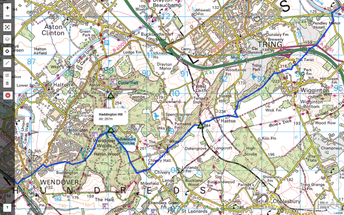
I have just about squeezed the walk onto this summary map at this scale. The walk starts in the top right-hand corner and proceeds south-west. This app will only highlight one summit at a time, but as well as Haddington Hill, Pavis Wood also has its green summit marker.
I reached Tring station via Milton Keynes Central, from where trains run two or three times an hour. From Wendover I caught a train to London, and these run every half an hour. I left Tring station at 10:35 and arrived in Wendover, allowing for some detours and backtracking, about three hours and forty minutes later.
Pub at end: The Red Lion Hotel, Wendover. Olde-worlde, but not in a bad way, and both the beer and background music were good. It is about five minutes’ walk from the station.
Distance walked: 8.5 miles/13.6km approximately.
Total ascent: 490ft/150m approximately.
Difficulty: ★★. Any gradients uphill are at best shallow, and often virtually imperceptible, although towards the end there is a steep descent into Wendover, on slippery chalk, that needs care. However, you should wear proper footwear as it is quite a muddy walk.
Ease of access: ★★★. Bearing in mind this is the Home Counties you’d think it might be four stars, and the walk would be a fairly simple day trip from London. But as it needs two different rail lines, it is more expensive even from there than it might be, and coming from further afield, and/or from the North or Midlands, will require changes of trains and added complexity (and expense). Plan ahead.
Scenic qualities: ★★. The opening passages are on good, clear tracks, with decent views, but this is not sustained throughout the walk. Neither of the two Tops are very distinguished, even Haddington Hill; if the monument wasn’t present to indicate that there you stand on the highest point of a range of hills (the Chilterns) that extend through four counties, you wouldn’t know it. And this cairn skulks under a tree, as if embarrassed about its lack of prominence. Good views are promised to the north, but largely blocked by woodland.
The area: This is not a part of the world I previously knew. I might have spent one night in Hitchin in 1998, that kind of thing. The territory of this walk is split 50/50 between the two counties. Hertfordshire’s claim on it is in a kind of ‘panhandle’ of its territory that extends up the gentle side of the Chilterns and claims a chunk of ground higher than anything around its bigger towns, like Watford and Stevenage, which will be more representative of the county. As for Buckinghamshire I know only Milton Keynes, which I just find a peculiar place. (This is now a separate local authority, so has its own modern Top.)
Both these counties are of ancient provenance, though, having existed in more or less their current form for at least a thousand years of documented history. Whether the Anglo-Saxon barons who carved them out could have foreseen their transformation into dormitories within the London commuter belt, their cosy domesticated landscapes and pubs turned into Thai fusion restaurants — who knows.
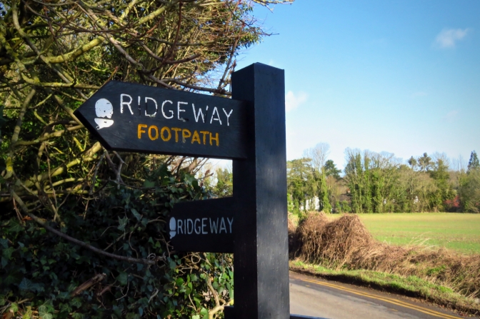
Map: An OS map is not essential on this walk. The first two-thirds of it takes place along the Ridgeway, which is one of the UK’s designated Long Distance Footpaths. Ample guidance is given by a succession of Ridgeway signposts (pictured), which point in both directions and can be relied on almost entirely. Even after leaving the Ridgeway, Google Maps and the printed maps and signposts in Wendover Woods got me round safely enough.
I did, however, drag round a very old, but still useful copy of the OS Landranger (1:50,000) 165 Aylesbury and Leighton Buzzard map.
Route: On departing Tring station, turn left and head west, past the white-painted hotel. The road passes a few houses then crosses the Grand Union Canal, where you should see your first Ridgeway signpost. As noted, you can safely rely on these to get you through the next several miles.
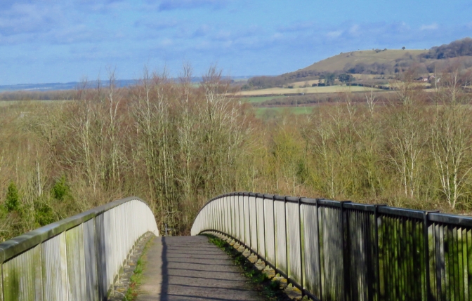
The path rises gently and pleasantly between fields before crossing the A41 Tring bypass on a very narrow bridge (see picture below). To the north-east can be seen Ivinghoe Beacon, a prominent little summit that is one of the termini of the Ridgeway LDP. Not long after the bypass is crossed, note the column of the OS trig point marked on the map at 216m (see the picture at the bottom of the page), proof that these points are sited not on summits as such, but on the best spots for taking a survey. This is quite apparent from here as this otherwise unassuming little trig has the most extensive view of the whole walk. There are some occasional good vistas from within Tring Park (the next substantial section) as well, but mostly, trees obscure what might be seen from this point on.
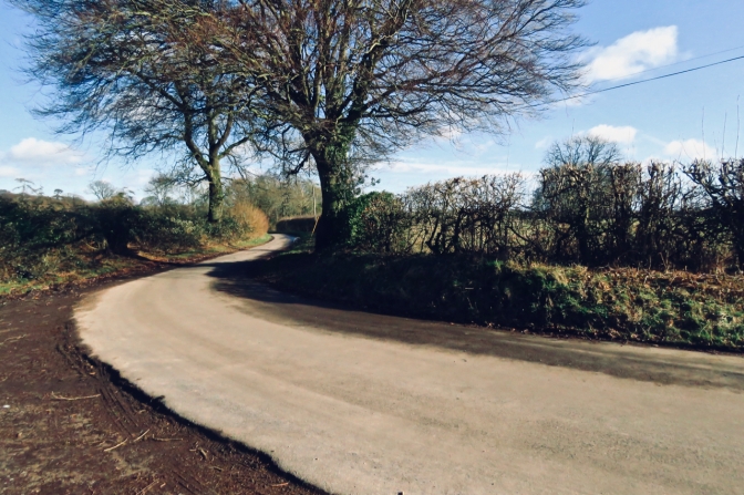
The first real routefinding task is to pinpoint the exact summit of Hertfordshire, sited just after the Ridgeway goes through the village of Hastoe, with its handsome village hall (presumably the highest such structure in the county). The county boundary hits tarmac just at the point the Ridgeway signs point you back off the road again, at SP914091 (the spot pictured below) and the summit is either right there, or in the bit of land in the crook of the bend, through the hedge. (On the day I did it the spot was defaced by the detritus of fly-tipping and three very dodgy looking blokes who were either doing a drug deal or making a gay porn movie; so not the greatest of crowns for the ancient realm of Hertfordshire.)
Buckinghamshire immediately introduces itself with mud, and the walk gets and stays rather swampier from the county boundary on. Keep following the Ridgeway signs through the woods and out into a more open area with a radio mast. One sign points you off the lane into a field, and you should take account of this as the road ahead (past Chivery Farm) is a dead end, so do follow the correct path here.
After traversing that field, it is time to leave the Ridgeway, which goes into Wendover, but not via the summit of Haddington Hill. As the path starts to slope downwards, you will see a notice board on the right (something about the rights of horse riders); take the relatively inconspicuous path to the right of it. This comes out at a right-angle bend in a woodland lane. Go straight on and follow the lane to the barriers of the car park that serves the visitor centre of Wendover Woods, a rather unexpected amenity.
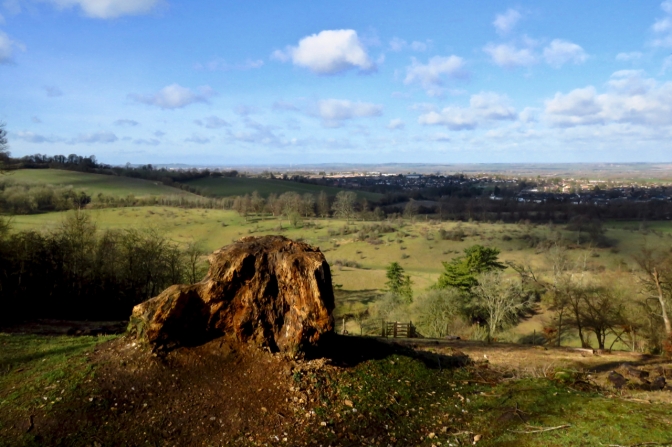
At the barriers, a sign states that down a little path lies the summit of the county, and of the whole Chiltern range. So it proves, but without the monument, no one would know. But at least there is something to mark the highest point of the day — even if does skulk under a tree. (See the picture at the top.)
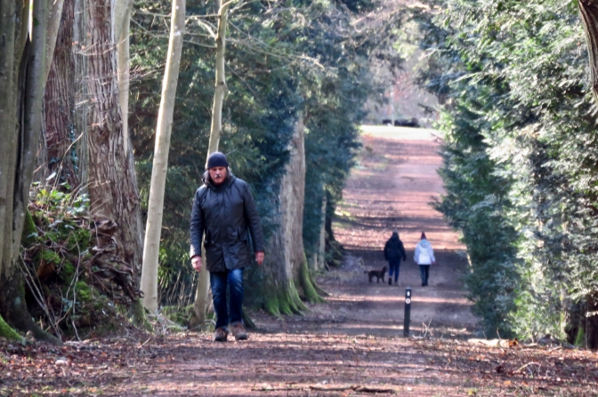
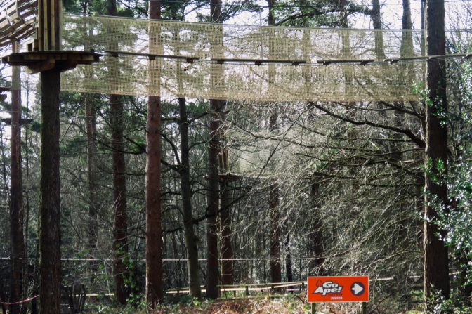
Return to the road and go on past the ugly ‘Visitor Centre’ and cafe. Take the path past the ‘Go Ape’ area with its zipwires and walkways (see pic) and follow the ‘Fitness Trail’ west for a short time before dropping down a wide and obvious path that offers the steepest gradient of the day, downwards. This turns into a tarmac road that suddenly debouches into a housing estate on the edge of Wendover. From here, finding the town centre and the railway station should be easy enough.
Ridgeway ramble commentary: Even excluding the Tops, both historic and modern, that serve two counties simultaneously, there are a number of pairs that are close enough to one another to make a ‘double-top’ walk plausible. Apart from today, these couplings definitely include (but are not limited to):
- Cambridgeshire and Essex;
- Northumberland and Roxburghshire: which is also a trans-national pairing (England and Scotland respectively);
- Kent and Greater London;
- St Helens and Wigan;
- Hampshire and Berkshire;
- Ayrshire and Kirkcudbrightshire.
There is also one possible triple, with three summits very close to each other in the Berwyns in north-east Wales; one historic only (Montgomeryshire), one modern only (Wrexham), and one both (Denighshire).
There are other possibilities, though the list is also realistic regarding my fitness (as in theory, one could do Coniston Old Man [Lancashire] and Scafell Pike [Cumberland] in one day for example: but only if one were a masochist). All in all though, I won’t need 196 separate walks to do all the Tops, and today was the first demonstration of this.
Not that either of today’s Tops were particularly impressive. But it was nice to reacquaint myself with the Ridgeway, a LDP that three and a half decades ago, I set out to walk with some friends before giving up a third of the way along thanks mainly to dreadful weather. We never got up to this part of the path; not that having seen it today, I regret it. The lack of many views on this walk was a bit of a disappointment.
Talking of dreadful weather, while 2020 has been a very clement and mild year thus far, this was definitely not the case on 9th February, last Sunday, when “Storm Ciara”, a vicious little wannabe hurricane, swept in off the ocean and dumped enough rain on my home town of Hebden Bridge to flash-flood it for the fourth time in eight years. The reasons why Hebden has a chronic flooding problem are not to do with ‘extreme weather’ first and foremost, but bad decisions about land use, particularly when it comes to how we do — or in this case, do not — manage to keep water up on the tops, rather than see it pour off the watersheds into the valleys. The lands above Hebden are privately owned and run as grouse moors, heathery plateaus off which water runs as if off concrete. This article from George Monbiot, which states the key facts pertinently and well, could have been written five years ago and eight years ago — and indeed was. The reasons why these things are not addressed is the result of gross incompetence at the political level. Past declarations on the undesirability and illegality of burning the heather moors have been ignored. After the three previous floods in his constituency, Craig Whittaker, our Conservative MP, voted against spending government funds on flood defence for the Calder Valley. With dickheads like this in charge of our local environment, who needs enemies.
I got this walk in due to a couple of days’ work in Milton Keynes earlier this week, and while it’s been good to bag the tops, the region hasn’t sold itself to me as a desirable place to hang out. The public transport is second-rate and unreliable, the hinterland a scape of blandness. I have explored, without really enjoying. But as other commitments and (next week) a total lack of trains have prevented me getting to the Lake District lately, it’s been an adequate subsitute. The next County Top walk for me will be in southern Scotland in early April.




11 thoughts on “7 and 8: Pavis Wood, Hertfordshire and Haddington Hill, Buckinghamshire”